Syria | Storm Elias begins its impact on Latakia and Tartous tomorrow, warning of very heavy thunderstorms and high chances of flash floods.
Arabia Weather - Sinan Khalaf - The latest outputs of the computer simulation systems for the movement of weather systems and our weather forecasts at the “Regional Arabia Weather Center” indicate that the western parts of Syria will be affected as of Sunday, specifically the coastal sector, by the direct effects of Storm Elias, in the form of highly heavy thunderstorms. It is accompanied by strong thunderstorms and an increased risk of flash floods.
Heavy thunderstorms and high risk of flash floods in parts of Latakia and Tartous
In details, the weather on Sunday is expected to be generally cloudy, with scattered showers of rain falling from time to time, sometimes accompanied by lightning and thunder. It may be locally heavy, but with the night hours the direct effects of Storm Elias will begin, starting in Latakia Governorate, especially the sector. The northern part, where the clouds become stronger and the frequency and intensity of rain increases to become very heavy, accompanied by the occurrence of lightning and thunder, with high chances of torrents forming and water levels rising in low-lying areas.
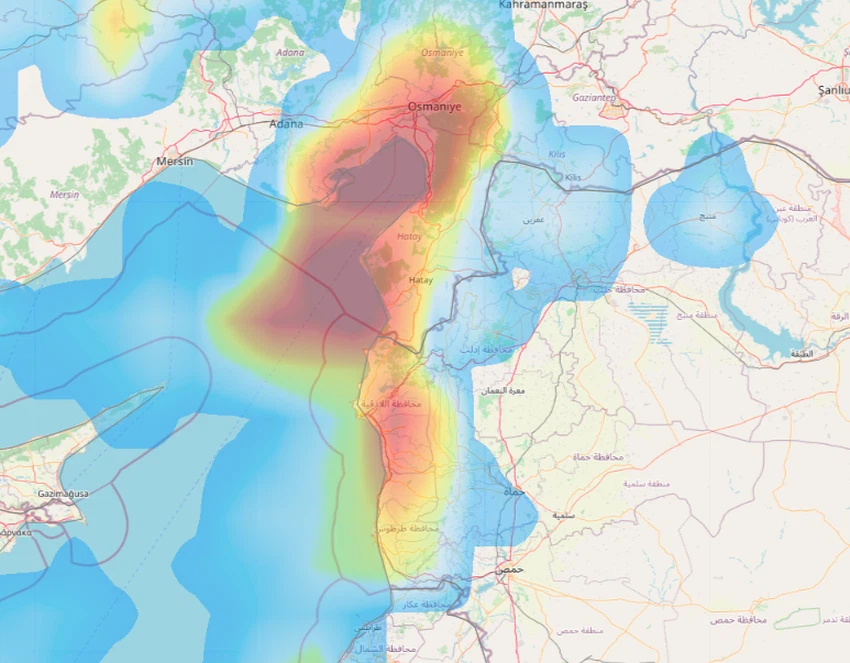
In the after-mid hours, rain clouds move towards the west and concentrate on Tartous Governorate, so that cumulus thunderclouds multiply and moderate and heavy rain falls, with increased chances of torrents forming locally.
As for Monday, the effects of Storm Elias on Syrian lands weaken, but the chances of rain continue in many coastal areas with varying intensity, sometimes heavy and accompanied by lightning and thunder, and God knows best.
Browse on the official website