The difference between depression and instability
Weather of Arabia - The term air depression is often mentioned in weather bulletins, and the term air instability, and it is important to understand each term and differentiate between them, so that we can understand the weather phenomena accompanying these cases.
The concept of atmospheric pressure and its relationship to temperature and humidity
Atmospheric pressure is defined as the weight of the air column located on a certain area of the earth, and the air column extends from the surface of the earth to the end of the atmosphere, and the amount of atmospheric pressure is affected by several factors, the most important of which are temperature and humidity, when the temperature decreases, the atmospheric pressure rises (with constant humidity), because cold air is heavier and denser than hot air, due to the convergence of its molecules, and when the temperature rises, the opposite happens. the heat).
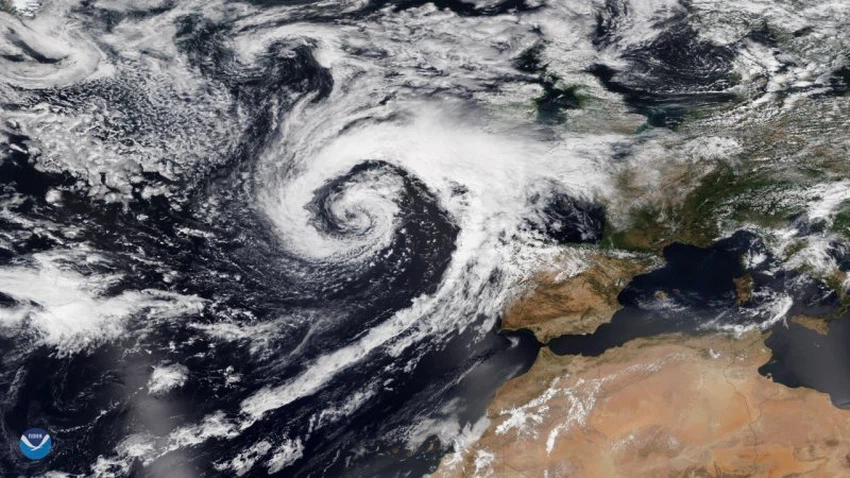
depression
It is mentioned that a certain region is under the influence of an atmospheric depression when the atmospheric pressure decreases from the neighboring regions, and the pressure drop coincides with lighter air, so it rises to the upper layers of the atmosphere, and revolves around the center of the depression in a counterclockwise direction (in the northern hemisphere), and when The air rises and cools, its content of water vapor condenses, forming clouds, and the depression causes certain atmospheric changes to the area it affects, such as: precipitation, strong winds, and a decrease in temperatures.
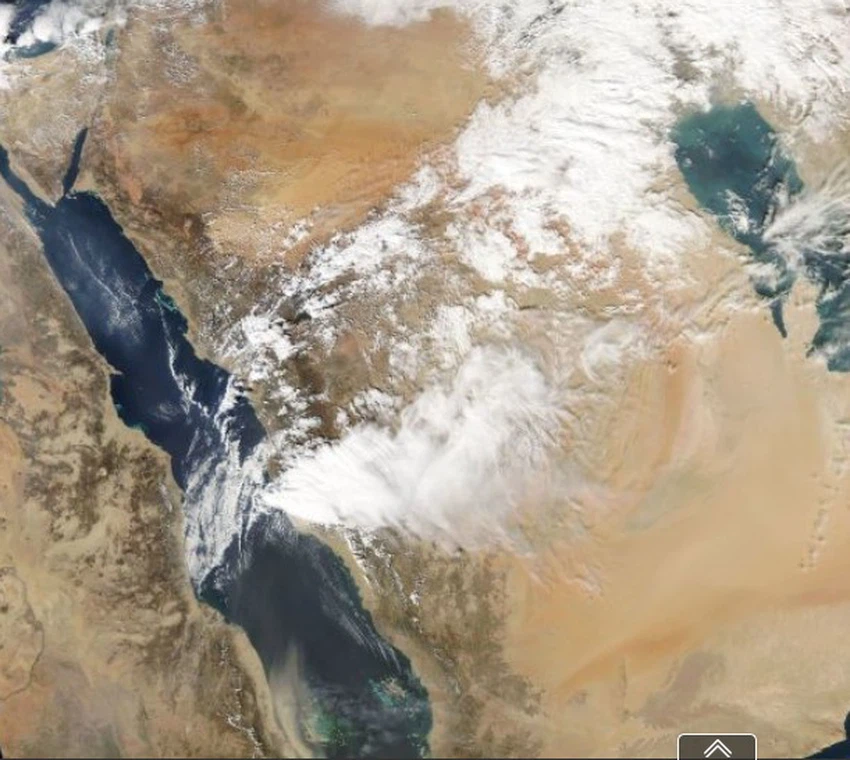
atmospheric instability
Atmospheric instabilities are formed in a different way from atmospheric depressions, when warm air rising from the lower atmosphere meets cold air descending from the upper atmosphere over a certain geographical area, in conjunction with the presence of moist air in the atmosphere, a situation arises From atmospheric instability, this condition leads to the formation of the so-called cumulus clouds, which grow vertically to the upper layers of the atmosphere, increasing their thickness, and accompanied by the occurrence of several weather phenomena, namely:
- Thunderstorms may be strong.
- Heavy rain, may be in a short period of time.
- Downdraft .
- Strong winds and sandstorms.
- Showers of hail, may be of large size, causing some damage.
The difference between atmospheric depression and atmospheric instability
Instabilities are usually formed in narrow geographic ranges or limited areas, and are not comprehensive such as depressions. A state of atmospheric instability may form at the top of the mountain, but the other parts at the bottom of the mountain remain completely stable, but if an air depression passes over the region, the rains It moves from the top of the mountain to the next part at the bottom of the mountain, and this is what distinguishes the atmospheric depressions. , in conjunction with its transfer to other regions.
The severity of the instability
Instability may become dangerous in some areas, resulting in the formation of flash floods , due to large amounts of rain falling in a narrow range and in a short period of time, especially in rocky areas, or mountainous areas that flow water. The rain in it from the top to the valley, and the presence of previous dry seasons helps in the occurrence of torrents because the rain water does not find channels for it to be absorbed into the ground, so the water remains accumulating on the surface of the earth. The speed of the flow of this water reaches 10 m/s, and it sweeps away everything in its path, even large objects such as vehicles and rocks, then it reaches estuaries that may be new, and it may pour into a river, sea or lake.
These torrents are also dangerous because of the mixing of water with dust that increases the turbidity of the water, and it becomes difficult to see the content of the water and the objects that move with it, and large rocks that move quickly with it can collide and strike the human body.
These torrents may move to a stable area, surprising the residents, or these torrents may increase in strength, break out of their streams, and strike other areas that may be inhabited, so it is necessary to follow the torrents streams, and to stay away from valleys, low areas and torrents when there is a state of instability air, or depressions.


Arabia Weather App
Download the app to receive weather notifications and more..