بالصور: أمطار غزيرة في عجلون

2014-10-19 2014-10-19T13:53:21Z
عمر الدجاني
عمر الدجاني
متنبئ جوي- مسؤول قسم الأخبار الجوية

موقع ArabiaWeather.com- وصلت تأثيرات المُنخفض الجوي مع ساعات عصر اليوم الأحد 19-10-2014 بشكل واضح إلى محافظة عجلون، وبدأ هُطول الأمطار بغزارة  تسببت في تشكُل السيول وارتفاع منسوب المياه في بعض الطُرقات.


وقد سجّلت محطة الرصد الجوي في عنجرة جنوب المُحافظة هُطول 3.5 ملم حتى الساعة الرابعة عصراً.

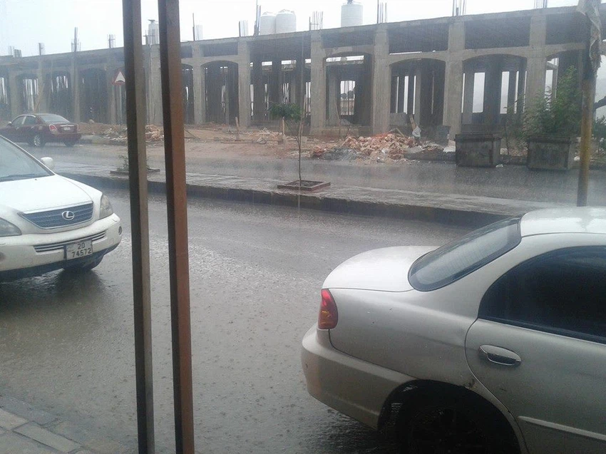
الصور أعلاه من الأستاذ عمّار الدرابكة، من قلب مدينة عجلون.


ويتوقع أن يزداد تأثير المُنخفض الجوي على المملكة خلال ساعات المساء، نظراً لعُبور جبهة باردة، تعمل بمشيئة الله على ازدياد قوة الأمطار وامتدادها لمناطق أوسع، حيثُ ستشمل بمشيئة الله شمال ووسط وجنوب المملكة وأجزاء من المنطقة الشرقية.


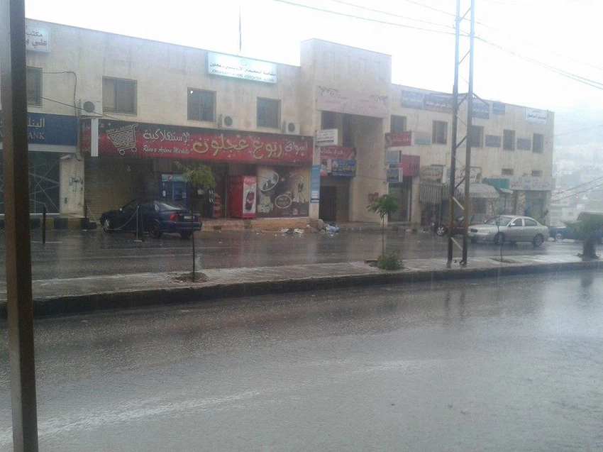
صورة: أمطار غزيرة وسيول في طرقات إربد


جبهة باردة وسريعة الحركة تتجه نحو المملكة وتعبر الأجواء مساءً

This article was written originally in Arabic and is translated using a 3rd party automated service. ArabiaWeather is not responsible for any grammatical errors whatsoever.
See More
Related News
Iraq is facing its worst drought crisis in 90 years.

Iraq is facing its worst drought crisis in 90 years.

Jordanians are in for an official holiday next month

Jordanians are in for an official holiday next month

The surge of massive polar air masses towards the North Atlantic is causing significant weather changes.

The surge of massive polar air masses towards the North Atlantic is causing significant weather changes.

Arab world: The first low-pressure system in November causes instability in these regions.

Arab world: The first low-pressure system in November causes instability in these regions.