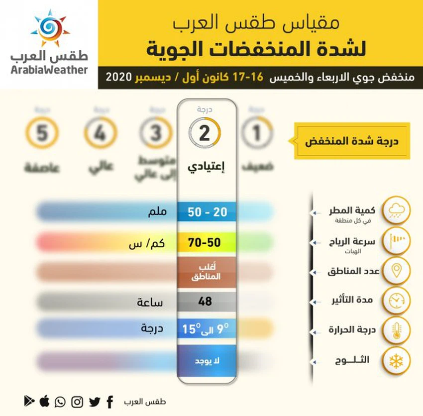
Jordan | A second-degree air depression (normal) affects the Kingdom on Wednesday and Thursday

Arab Weather - Temperatures drop on Tuesday / Wednesday night and cold weather prevails in all regions, with the emergence of clouds at different heights, and gradually during the passage of the night hours opportunities are created again for showers of rain in some areas, especially the northern ones, with the formation of fog In the mountainous highlands and the eastern plains.
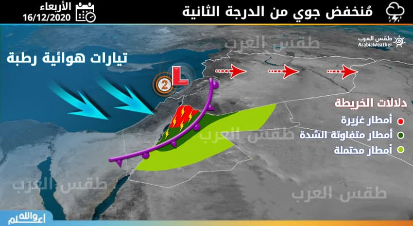
A rainy air front accompanying an air depression begins to cross the kingdom's airspace on Wednesday morning and day!
According to the latest numerical outputs, it is expected that the Kingdom will cross in the hours of Wednesday morning a rainy, slow-moving air front accompanied by a second-class ( regular ) air depression located off the Lebanese coast, where the rains become more regular, starting from the northern regions, and the rains extend during the passage of daylight hours and the period The back towards the central regions and later towards some of the southern highlands and the eastern regions.
The rains are of varying intensity, engulfing at special periods after in the afternoon hours, especially in the northern and central regions, with the weather continuing to rain at intervals throughout Wednesday, and fog forms as a result of crossing low clouds that touch the surface of the earth.
The rain continues at intervals until Thursday evening hours!
The Kingdom continues to be affected by the air depression during the hours of the morning and day on Thursday, as the rains continue to rain at intervals in parts of the northern and central regions, and may affect other regions, and the impact of the air depression will decline in the Kingdom during the hours of the evening and night of Thursday, with the weak chances of rain and the return of the atmosphere to gradually stabilize night.
⚠️ Recommendations
1 - Be aware of the risk of floods forming and the flow of valleys and reefs in some areas.
2- Attention to the risk of low horizontal visibility due to fog formation, especially in mountainous heights.
God knows.


Arabia Weather App
Download the app to receive weather notifications and more..