Saudi Arabia | A cold wave affects the Kingdom, pushing strong winds and dust waves in many regions at the end of the week

Update || Sunday 03/13/2022 at 1:00 pm
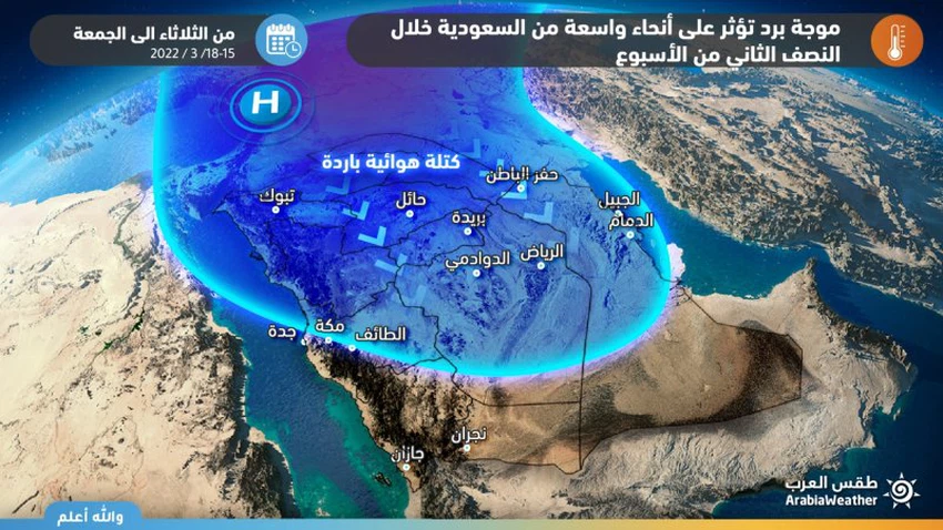
Arab Weather - The latest output of the computer simulation systems running in the Arab Weather Center indicates the possibility that large parts of the Kingdom will be affected by a cold wave that begins on Tuesday and expands at the end of the week to include most regions of the Kingdom, and due to the expected huge thermal differences, the winds that provoke dust waves in many areas voluntarily activate in many areas. Allah.
Significant drop in temperatures
Active winds raise dust waves in many areas
In the details, a cold air mass will move towards the north of the Kingdom through the Levant on Tuesday, bringing the temperatures down from Al-Jawf and the northern borders and Tabuk, and the cold air mass will expand on Wednesday so that the temperature continues to decrease in the north of the Kingdom to reach large parts of the east and center of the Kingdom in addition to the coastal strip of the Red Sea, Where temperatures are recorded below zero Celsius as a minimum in the north of the Kingdom, with risks of frost formation in those areas.
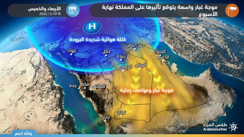
At the same time, the northeastern winds are active and are associated with strong gusts that sometimes exceed the 60 km/h barrier in some areas, and as a result, dust waves are formed in different parts of the eastern, central and southern parts of the Kingdom, God willing.
Computer modeling analyzes show that the cold air mass will continue to deepen in the atmosphere of Saudi Arabia on Thursday, dominating most regions of the Kingdom, so that it becomes several degrees below its normal rates for this time of the year, and this would increase the speed of wind activity to become severe in Many regions, especially the eastern and southern Riyadh administratively, all the way to the south of the Kingdom, and as a result of these winds and their possible consequences, it is expected that they will form large-scale dust waves and be associated with a significant decrease in the range of horizontal visibility.
Operations management specialists at the Arab Weather Regional Center for Meteorology and Forecasting periodically review around the clock the outputs and analyzes of weather readings and issue updates if necessary, God willing.


Arabia Weather App
Download the app to receive weather notifications and more..