Arab World | Seasonal thunderstorms expected in several Arab countries this week... Details
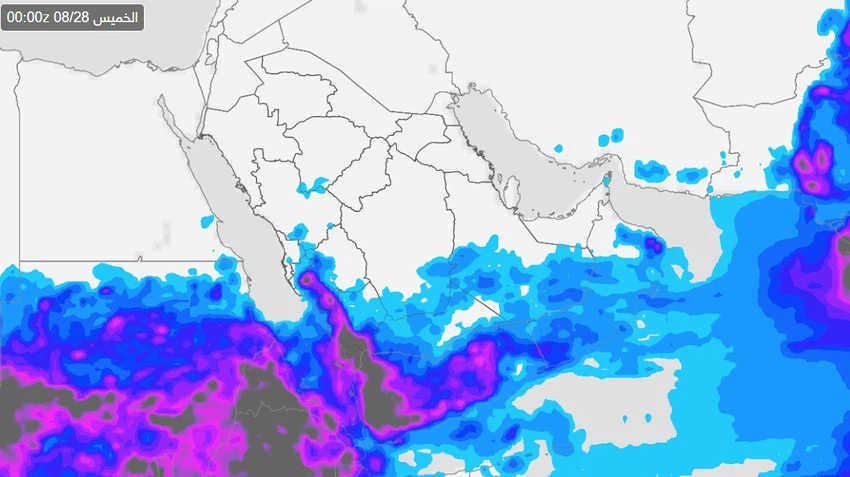
The latest numerical model outputs available through the Arab Weather app indicate that atmospheric instability will continue to affect large parts of the Arab world over the coming week, with the formation of thunderstorms and active dust-raising winds. Weather events will be concentrated in areas of Saudi Arabia, Yemen, the Sultanate of Oman, the UAE, and Sudan.
Saudi Arabia and Yemen: Thunderstorms accompanied by lightning, thunder, and hail.
Humid tropical winds continue to flow towards the southwestern highlands of Saudi Arabia, especially Jazan, Asir, Al-Baha, and Taif, reaching as far as Makkah and the south of Madinah. Cumulonimbus clouds are expected to form daily during the afternoon and evening hours, with heavy rains sometimes accompanied by hail and strong downdrafts. There is a possibility of valleys flowing and flash floods in mountainous areas.
In Yemen, the effects of the weather conditions extend to the western highlands, where thunderclouds are multiplying, with rainfall of varying intensity, sometimes accompanied by active surface winds that stir up dust.
Sultanate of Oman: Rain chances continue next week
Humid monsoon winds continue to sweep across the mountains of the Sultanate of Oman, leading to the formation of cumulonimbus clouds during the afternoon and evening hours, with varying intensity of rain, sometimes heavy, which may cause valleys and mountain ravines to overflow.
Forecasts indicate that these clouds may occasionally extend towards the eastern mountains of the UAE, particularly areas near the Omani border, while major cities remain outside the direct range of influence.
Sudan | Possible flooding due to continued rains
Tropical humidity continues to flow across large areas of Sudan, leading to the formation of dense thunderclouds that cause intermittent heavy rainfall. This is coupled with the potential for rising water levels, flash floods, and limited flooding in low-lying areas and areas near valleys.
Important recommendations from Arab Weather
- Beware of flash floods in mountainous and sloped areas.
- Drive with caution during rain or reduced visibility due to dust.
- Follow the latest weather forecasts for Saudi Arabia, Oman, Yemen, and Sudan via the Arab Weather app and website.


Arabia Weather App
Download the app to receive weather notifications and more..