بالصور: السيول تُغرق الحي الشمالي في مدينة إربد

2014-10-19 2014-10-19T15:32:57Z
عمر الدجاني
عمر الدجاني
متنبئ جوي- مسؤول قسم الأخبار الجوية

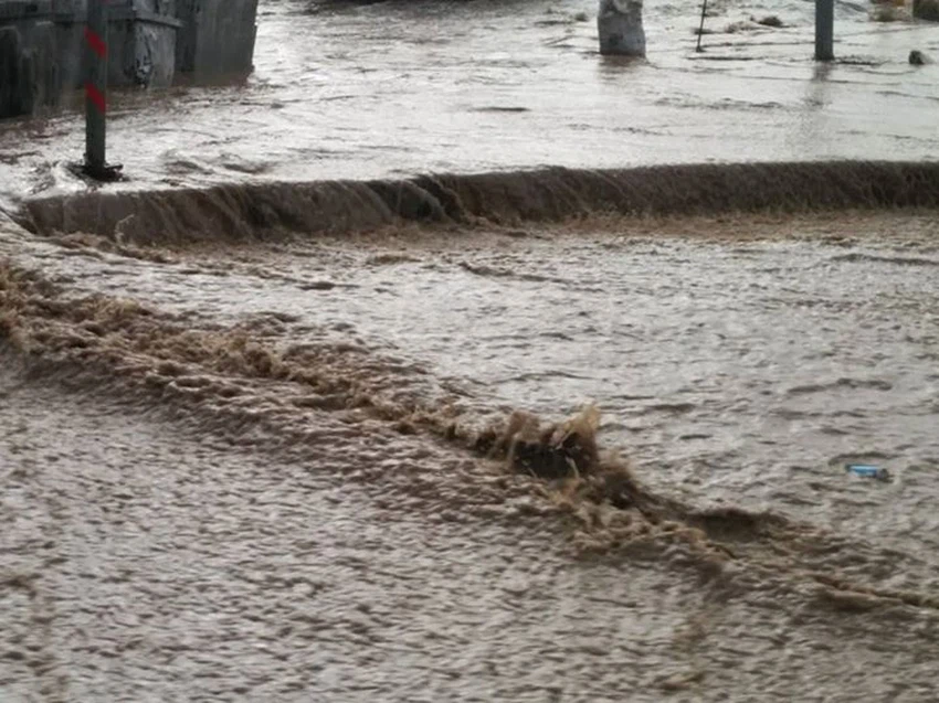
موقع ArabiaWeather.com- بدأت الجبهة الهوائية الباردة الوحيدة المرافقة لهذا المُنخفض الجوي بالعبور مع ساعات مساء الأحد 19-10-2014، حيثُ هطلت أمطار شديدة الغزارة على مُحافظات إربد وعجلون، وهو ما أدى إلى ارتفاع منسوب المياه بشكل خطير في عدد من الطرقات والأحياء.


وسجّلت محطة الرصد الجوي في محطة رصد إربد مُعدّل أمطار عالي وصل إلى 70 ملم/ساعة، ولو أن الهُطول استمر لفترة طويلة لكُنا نتحدث عن خسائر ماديّة واضحة، وبلغت كمية الامطار الهاطلة إلى غاية الساعة السادسة 10.1 ملم.

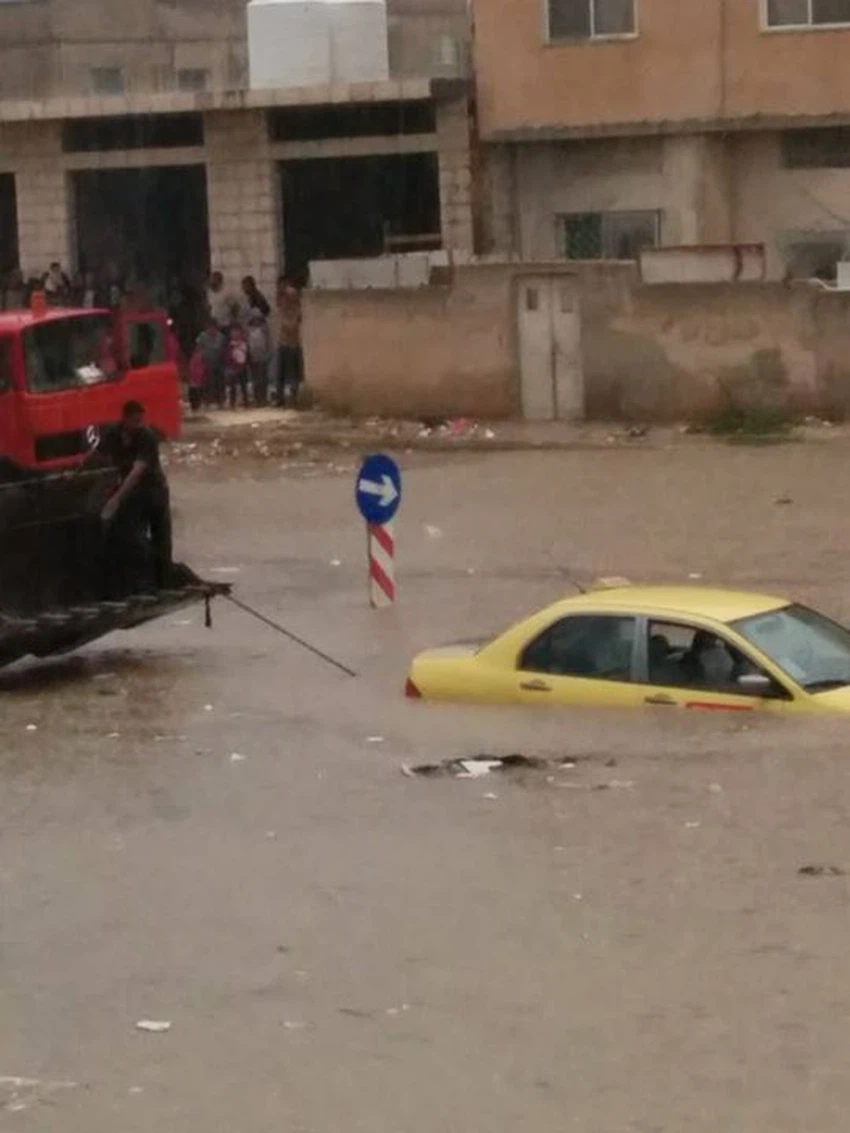
الصور توضح قوّة السيول في الحيّ الشمالي لمدينة إربد، والذي غرق بالمياه بكُل ما تحمله الكلمة من معنى،وهي من تصوير صالح أبو شقرة.


ويتوقع أن تمتد الأمطار خلال الساعات القادمة إلى مناطق أخرى من شمال ووسط وجنوب البلاد، إضافة إلى الأجزاء الشرقية.

This article was written originally in Arabic and is translated using a 3rd party automated service. ArabiaWeather is not responsible for any grammatical errors whatsoever.
See More
Related News
A series of low-pressure systems over the western Mediterranean are pushing warmth and dust towards Jordan.

A series of low-pressure systems over the western Mediterranean are pushing warmth and dust towards Jordan.

Important: Official working hours will be adjusted during the holy month of Ramadan.

Important: Official working hours will be adjusted during the holy month of Ramadan.

Do the indicators suggest the arrival of low-pressure systems next week?

Do the indicators suggest the arrival of low-pressure systems next week?

What is a polar vortex and what are the reasons for its splitting, after God's will?

What is a polar vortex and what are the reasons for its splitting, after God's will?