هام .. طقس العرب يكشف عن المسار المرجح للعاصفة المدارية هيكا ومناطق تأثيرها
2019-09-23
2019-09-23T10:19:50Z

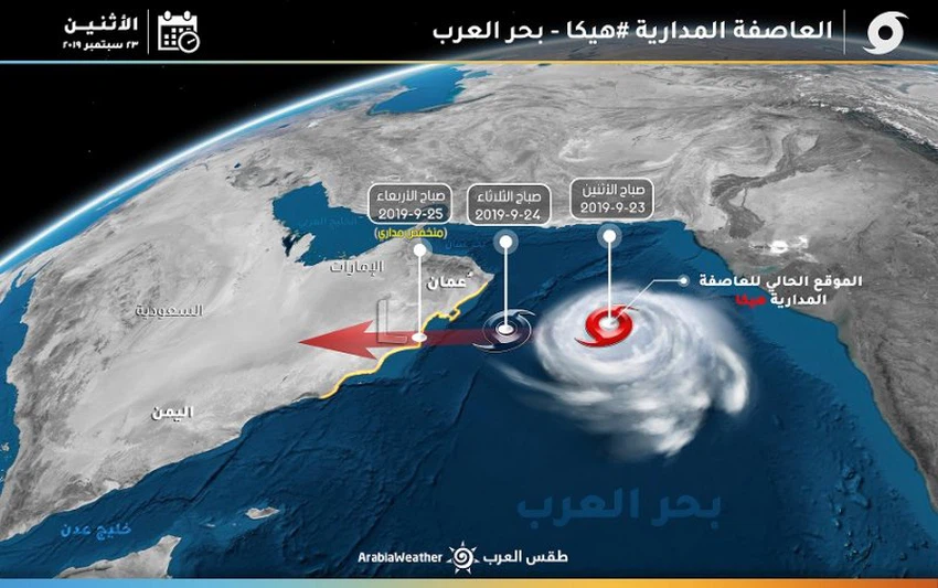
طقس العرب - سنان خلف - توقع كادر التنبؤآت الجوية في مركز طقس العرب الإقليمي أن تتحرك العاصمة المدارية هيكا بالاتجاه الغربي والجنوبي الغربي نحو سواحل سلطنة عُمان، وأن تبدأ بالتأثير المباشر على سواحل السلطنة اعتباراً من يوم غدٍ الإثنين.
مناطق التأثير والمسار المُرجح
ويُتوقع أن تؤثر العاصفة المدارية هيكا على جزيرة مصيرة، ثم تتحرك نحو محافظتي ظفار والوسطى، تترافق بعد مشيئة الله برياح نشطة إلى قوية السرعة مصحوبة بأمطار متوسطة إلى غزيرة بشكل عام.
مؤشرات على تراجع قوة العاصفة المدارية هيكا لدى ملامستها سواحل عُمان
وتوقع كادر التنبؤآت أن تتراجع العاصفة المدارية هيكا بتصنيفها إلى منخفض مداري لدى ملامستها لسواحل سلطنة عُمان نتيجة لرياح لنشاط رياح القص الشمالية الشرقية وبرودة سطح المياه في هذه المنطقة من بحر العرب
This article was written originally in Arabic and is translated using a 3rd party automated service. ArabiaWeather is not responsible for any grammatical errors whatsoever.


Arabia Weather App
Download the app to receive weather notifications and more..