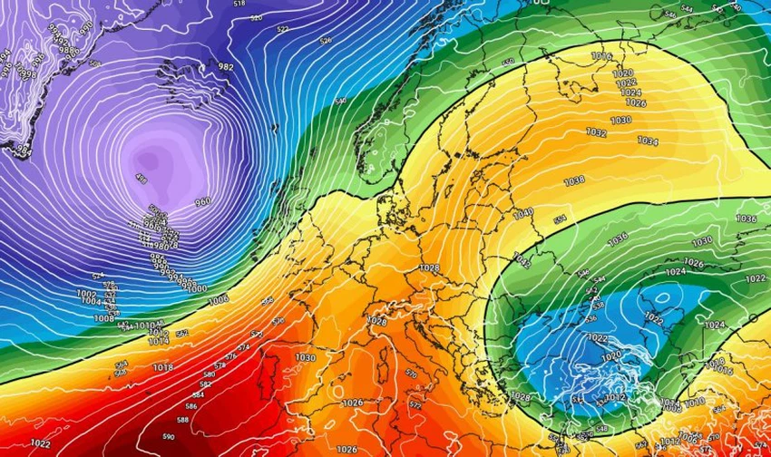
A strong high pressure system is controlling western Europe and causing a huge polar air mass to rush towards eastern Europe.

Arab Weather - Weather experts at the Arab Weather Regional Center are following the latest developments in weather systems in the Northern Hemisphere, as computer simulation results indicate the possibility of a very cold and unusual air mass arriving at this time of year, characterized by polar characteristics, which may reach eastern Europe and northern Asia early next week.
A huge, very cold air mass is heading towards Eastern Europe early next week.
In detail, experts indicated that as a result of the formation of a strong high pressure system in large areas of western and central Europe, the polar jet stream is undulating and an extremely cold air mass of polar origin is rushing towards eastern Europe and northern Asia.
According to initial indications, Eastern Europe, including Turkey and North Asia, will be affected by this polar mass, which will lead to a significant drop in temperatures and very cold and rainy weather, which may be accompanied by snowfall in high altitudes, including the Turkish highlands.
Will the cold air mass affect the eastern Mediterranean?
God willing, the polar air mass is expected to affect vast areas of the countries of the eastern Mediterranean basin, including the Levant, Iraq, and the northern Arabian Peninsula, specifically Saudi Arabia and Kuwait, and will be accompanied by significant changes in weather conditions and temperatures. You can view weather details via the all-new Arab Weather app.
And God knows best.


Arabia Weather App
Download the app to receive weather notifications and more..