As of Thursday evening | New `normal` second-tier air depression ... followed by a strong ice wave

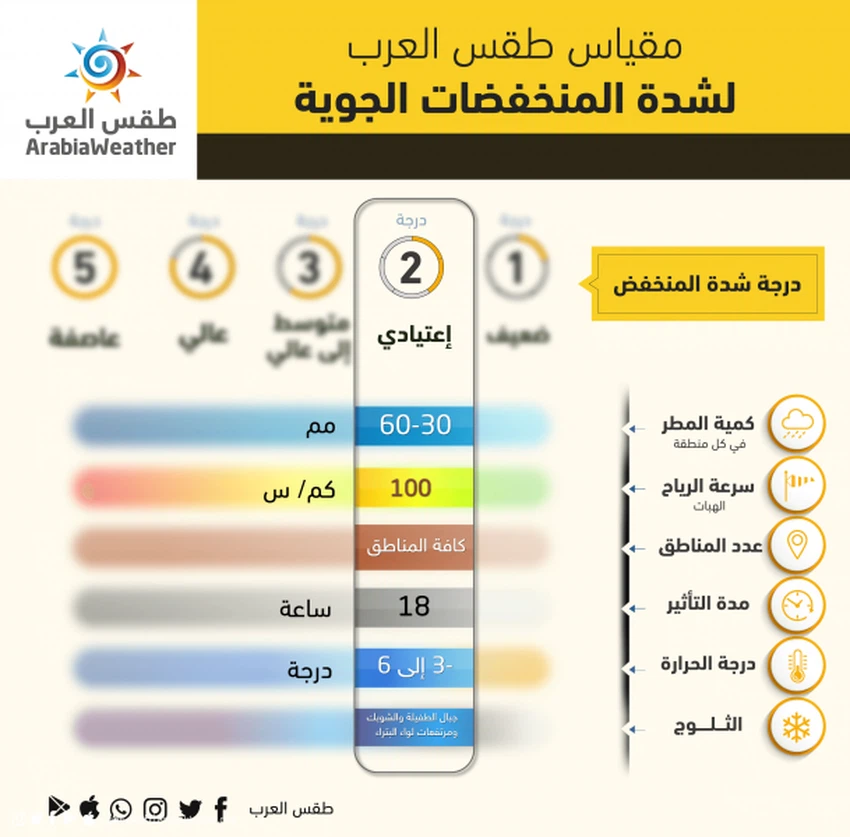
Weather of Arabia - A second-degree "normal" air depression according to the Arab Weather classification is expected to affect the severity of the weather depression, God willing, from Thursday evening to Friday afternoon.
The effect of this depression comes as a result of the persistence of an elevated air position in all layers of the atmosphere in the European continent, which leads to the eruption of a very cold, polar air mass, originating towards the Turkish lands and the Levant .
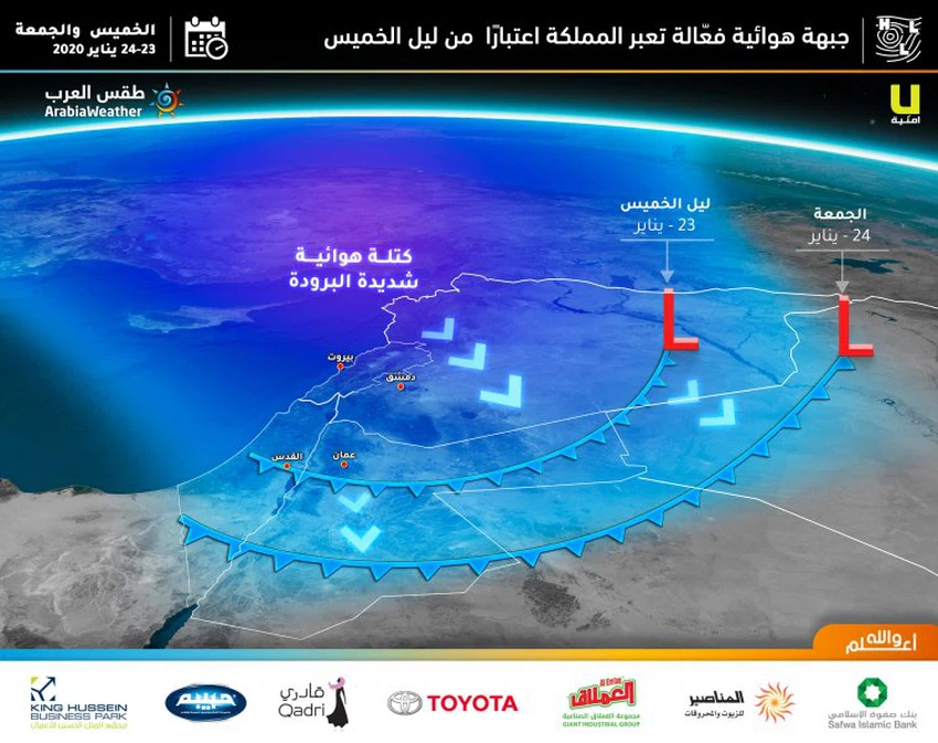
The impact of the "fast effective" air depression begins in the northern regions of the Kingdom from evening and night Thursday / Friday in the north of the Kingdom, it will soon extend later with the late night hours and Friday morning for the central regions of the Kingdom, and continue until Friday afternoon.
Snow expected on the southern highlands
Snow is expected to fall and accumulate over the high mountains of the South, especially in Tafila and Shoubak.
The Arab weather again denies the news circulating about an expected snow accumulation in the capital, Amman
Heavy rain and strong winds followed by widespread freezing
The Arab weather forecasts that the depression will be accompanied by heavy amounts of rain throughout the Kingdom, and by strong western winds.
The depression will be followed by very cold polar winds of origin, which will lead to the formation of large-scale freezing on the roads in all regions of the Kingdom, including the main Jordanian cities, on Friday evening and Friday / Saturday night, where the minimum will drop to around zero percentile or below, and the "surface" temperature will be Less than that, and here emerges the danger of freezing rain water that would have fallen earlier on the roads, with the early hours of Friday / Saturday night, as Jordanian roads usually witness traffic activity on Friday evening and Saturday night.
During the weather, the Arab weather recommends that you pay attention to:
- The risk of floods and high water levels due to the heavy rains in the north and center of the Kingdom .
- Be aware of the intensity of the wind gusts, the speed of which is near the 90-100 km / h barrier .
- Danger of low horizontal visibility due to dust in the southeastern Badia regions .
- The risk of declining horizontal visibility due to fog and clouds touching the surface of the earth over the mountainous heights.


Arabia Weather App
Download the app to receive weather notifications and more..