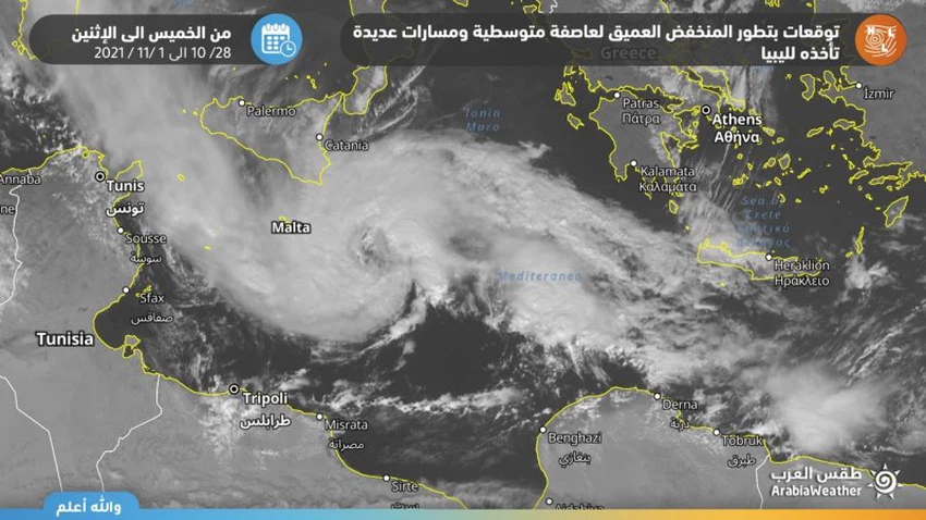
Observation of a remarkable rotation of clouds in the middle of the Mediterranean Sea and expectations of the development of the situation for a Mediterranean storm in the coming hours

Arab Weather - Satellite images at 13:00 GMT monitor a spinning of clouds around the center of a deep depression in the central Mediterranean, specifically to the northeast of the Libyan capital, Tripoli, and the air system is moving towards the northeast, that is, towards the Italian island of Sicily in the coming hours.
Most numerical models predict the development of the weather system for a Mediterranean storm within a few hours
The outputs of most global numerical models indicate a rapid development of the atmospheric depression and an additional decline in the atmospheric pressure values, supported by the warm waters in the middle of the Mediterranean, to hit the island of Sicily and southern Italy on Friday in the form of a Mediterranean storm bringing with it heavy rain, strong winds and high waves.
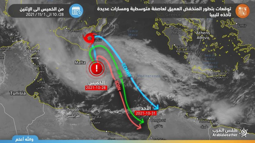
These models also expect that the Mediterranean storm will move on Saturday towards the southeast, that is, directly towards the coasts of eastern Libya, specifically the coasts of Benghazi and the Gulf of Sirte, but with a decrease in its intensity to a deep depression again, bringing with it heavy rain, strong winds and high waves towards the eastern coasts of Libya on Sunday.


Arabia Weather App
Download the app to receive weather notifications and more..