Saudi Arabia: Details of a rainy spring situation that includes large areas of the Kingdom during the coming days

Arab Weather - Specialists in the Air Operations Department at the Arab Weather Regional Center for Weather Forecasts stated that the Kingdom of Saudi Arabia is on a date with large-scale weather disturbances during the coming days, as a result of the crossing of an upper wave that will gradually penetrate into the Arabian Peninsula and be reinforced by the Red Sea thermal depression and its proximity From the tropical humidity, it will cause, God willing, spring rains of a spring nature, that is, it will be associated with the occurrence of thunderstorms and activity in the downward winds that stir dust and dust.
Cumulonimbus clouds intensify on the southwestern highlands on Thursday, including the city of Taif, and extend to some central regions
It is expected, God willing, that the depression in the upper layers of the atmosphere will approach the atmosphere of the Kingdom on Thursday, in conjunction with an extension of the Red Sea depression from the south, so that quantities of cumulus clouds will multiply in the afternoon and evening hours over the heights of Jazan, Asir, Al-Baha and Makkah Al-Mukarramah, including the city of Taif, and this rain is mostly medium, but it is interspersed with heavy foci in some areas that lead to the flow of valleys and reefs.
It is possible that some local clouds will multiply over parts of the south of the Al-Madinah Al-Munawwarah region, and rainy clouds will extend to parts of the Riyadh region administratively, especially the north of the region, Qassim and southern Hail, and some limited clouds may extend to the north of the eastern region, and these rains will be light. to mostly medium in these regions.
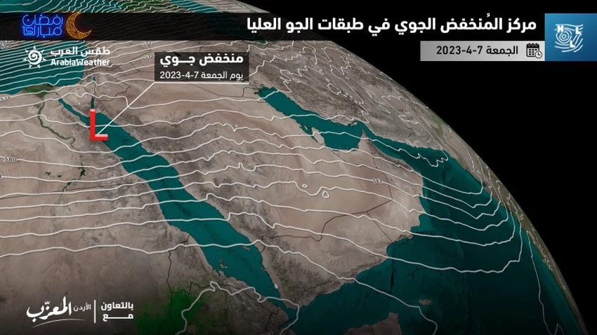
On Friday, Saudi Arabia was affected by the rainy situation, to include large parts of the Riyadh region administratively
And the Kingdom is increasingly affected by the rainy situation on Friday, with the approach of the upper wave, so that moderate rain is expected interspersed with heavy spots on several parts of the heights and east of the heights of Makkah Al-Mukarramah and the south of the Medina region, with the possibility of flowing valleys and torrents, and rain clouds gradually extending It extends to different parts of the Riyadh region administratively, especially the western governorates, in addition to parts of Al-Qassim and Hail.
Mostly moderate rains are expected in parts of the highlands of Asir and Al-Baha, in addition to parts of the Najran region and the north of the eastern region.
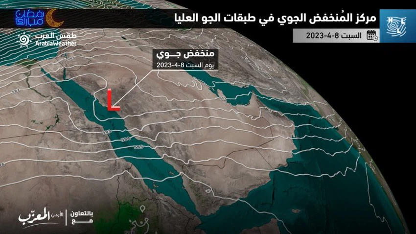
Saturday and Sunday: The southwestern highlands are increasingly affected by weather disturbances, and a warning of heavy rains in those areas, including the holy capital, and some rains affect neighborhoods of the city of Jeddah.
And the upper wave will deepen over the Kingdom’s atmosphere at the beginning of next week, April 8 and 9, 2023, and the depression will be concentrated in the upper atmosphere layers at the time, west of the Kingdom, in conjunction with an effective response to the Red Sea depression and the flow of quantities of moisture with tropical characteristics. So that it is expected that medium to heavy rains will fall on large parts of the heights of Asir, Al-Baha, and Makkah Al-Mukarramah, including the holy capital, and cause valleys and reefs to flow, in addition to a rise in the water level.
It is also not excluded that some sporadic rain clouds, which are accompanied by light to moderate rains in their entirety, will extend to neighborhoods of the city of Jeddah, especially the eastern parts of it.
In the same period, it is expected that several parts of Al-Madinah Al-Munawwarah and the Riyadh region (especially the southwestern and western parts of it) will witness mostly moderate rains interspersed with some heavy spots, in addition to separate parts of the regions of Najran, Jazan, Hail, Qassim, Al-Jawf, and Tabuk, but it is expected that the rains will be sporadic in their entirety, affecting the governorates rather than other of these regions.
A new Alawite wave in the middle of next week, and an expected follow-up in the rainy spring cases in the Kingdom!
And the latest weather readings in the Arab Weather Center indicate expectations of a new upper wave rushing into the atmosphere of the Kingdom of Saudi Arabia in the middle of next week, in conjunction with the continued flow of huge amounts of water vapor, which carries tropical characteristics and which represents fuel for the growth of cumulus clouds and their arrival at high altitudes, so that it is expected, God willing, The range of cumulus rain clouds will expand in the middle of next week to include new areas. And the Arab Weather will provide you with more details, God willing.
God knows.


Arabia Weather App
Download the app to receive weather notifications and more..