The Beirut explosion and the effects of the damage it caused, as they appeared from outer space ... with videos and photos

Arab Weather - Satellite images monitored the Beirut capital explosion on Tuesday 4 August 2020, confirming the magnitude of the explosion
Satellite images also show the effects of the explosion at the Beirut port, where a photo taken by the satellite company BlackSky shows severe damage to the port after the explosion.
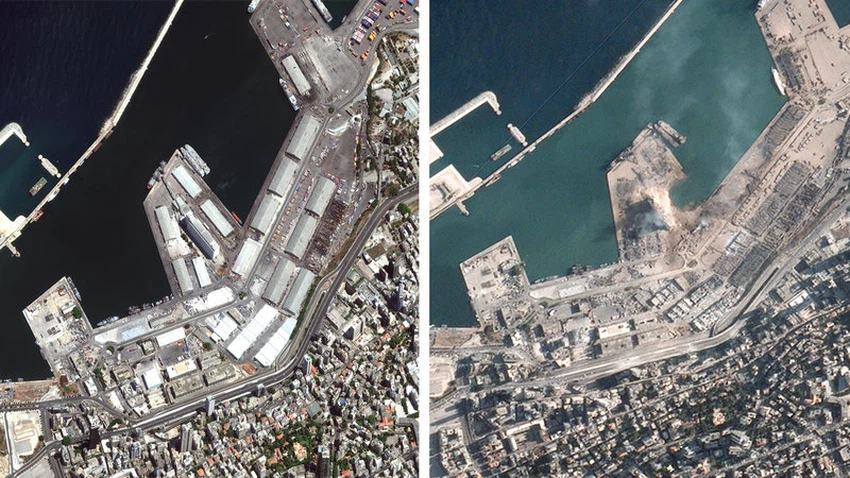
It appears that many warehouses were destroyed and flattened and can be seen
In the photo, debris can also be seen covering a major road more than 1,000 feet south of the explosion site, which is a sign of the force of the explosion.
The blast killed at least 100 people and injured thousands more .
A BlackSky image and an image from Planet Trading Company show a plume of smoke or debris still rising from the site around 8:00 AM local time Wednesday, more than 12 hours after the explosion .
Before and after SkySat imagery shows the impact of yesterday's explosion in Beirut.
Imagery captured on May 31, 2020 and today, August 5, 2020. pic.twitter.com/8zCLDOZn4w
- Planet (@planetlabs) August 5, 2020


Arabia Weather App
Download the app to receive weather notifications and more..