Urgent | Cyclone Tej in the Arabian Sea has developed into Category 3 and Oman Meteorology issues Warning No. 1

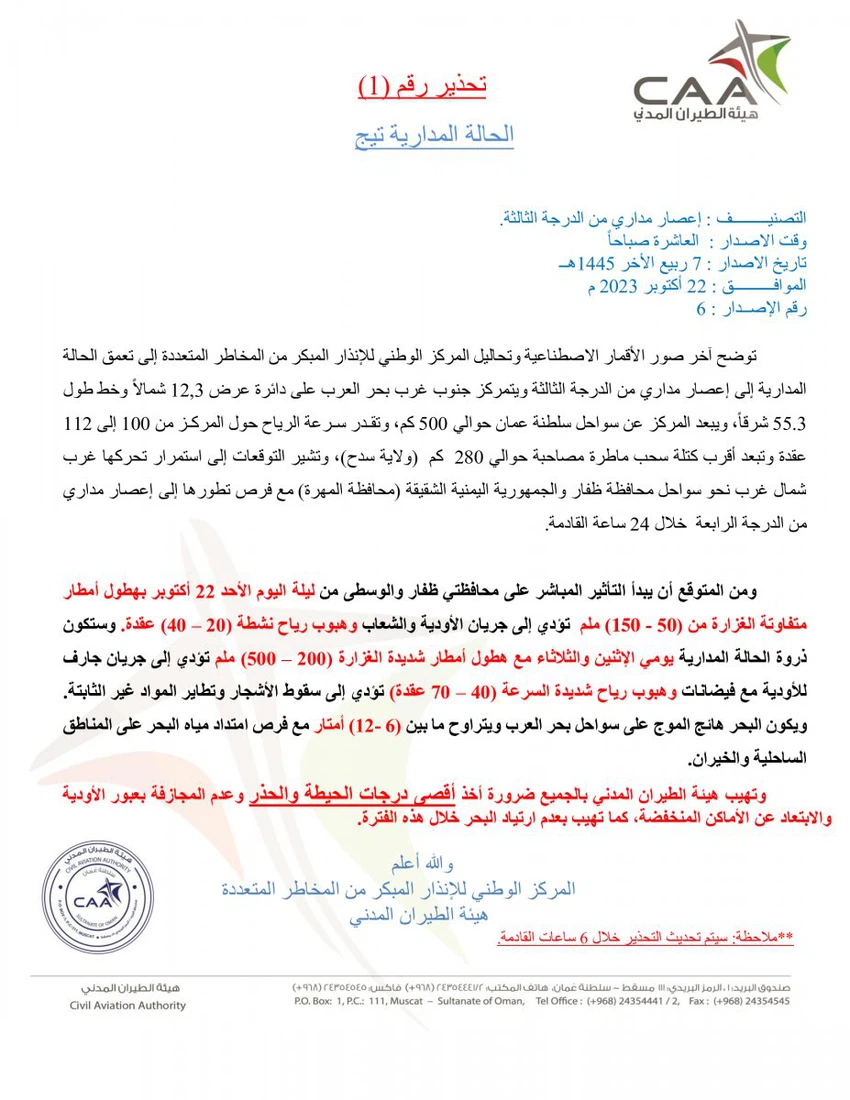
Weather of Arabia - Sinan Khalaf - With the development of Cyclone Tej in the Arabian Sea to Category 3 , the National Multi-Hazards Early Warning Center issued Warning No. 1, which stated:
“It is expected that the direct impact on the governorates of Dhofar and Al Wusta will begin from the night of Sunday, October 22, with rain of varying intensity (50 - 150) mm, leading to the flow of turbidites and reefs and active winds blowing (20 - 40 knots), and the peak of the situation will be on Monday and Tuesday with heavy rains. Heavy rain (200-500) mm leads to the fall of trees and the flying of unstable materials. The sea will be rough on the coast of the Arabian Sea, ranging between (6-12) meters, with opportunities for sea water to enter the coastal areas and creeks.
More details in the attached report:


Arabia Weather App
Download the app to receive weather notifications and more..