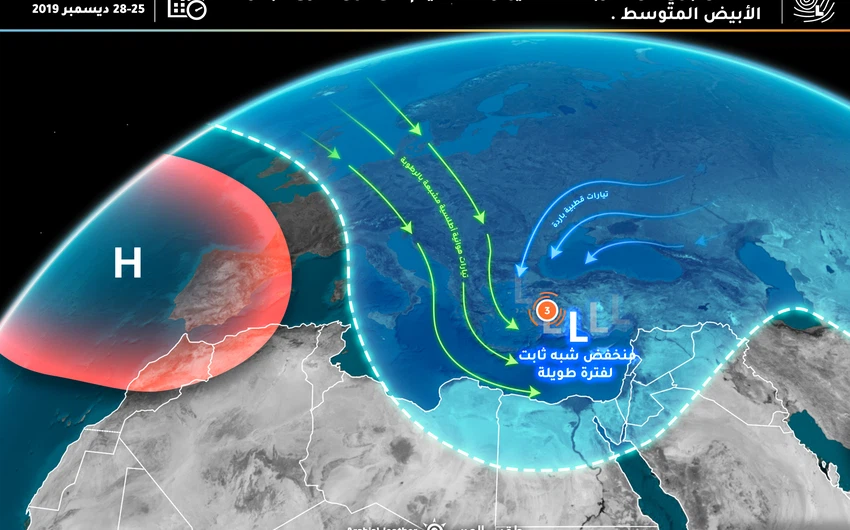
Wednesday A third-degree (low to high effective) air depression is gradually approaching the Kingdom
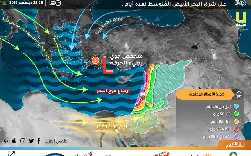
Weather of Arabia - A third-class (low-medium to high-effective low-air) depression is centered on southwestern Turkey and is slowly moving eastward towards western Cyprus island on Tuesday / Wednesday night, where it is expected to become its center on Wednesday over the island of Cyprus
On Wednesday, as the air depression centered on the island of Cyprus, an active southwesterly wind blows dust and dust to the Kingdom, where the weather is cold, windy, and dusty throughout the Kingdom. Wind speeds reach 80 km / hour and possibly more than the southern mountain peaks .
Chances of rain on the northern region start from the hours of Wednesday evening, where a cold air front begins to cross the airspace of the kingdom, then gradually and with night hours the chances of rain (with less intensity) include the central region, including the capital Amman, where the capital Amman is at the tip of the cold air front, As the south-western winds continue to blow, the wind will continue
Chances of rain continue during the hours of Wednesday / Thursday night, provided that the air activity will decrease slightly during the morning and noon Thursday from the central region, while rain opportunities remain in the northern region.
With Thursday evening hours, the center of the air depression will move towards the coasts of Syria, and a new cold front begins to cross the Kingdom's airspace where renewed rain falls on the northern and central regions, as well as parts of the southern region where the rain precipitation is sometimes heavy and associated with the cold precipitation, with continuing flames. Strong southwest winds where the weather is cold and windy and rainy during night hours.
Low clouds that touch the surface of the earth cover the high mountain peaks from the northern region, as well as the central region, on Friday morning hours.
Arab weather recommends that you pay attention:
- The low visibility due to dust in different parts of the Kingdom, especially the southern and eastern regions.
- The formation of torrential rain and high water levels in parts of the north, sometimes due to heavy rains.
Arabia Weather App
Download the app to receive weather notifications and more..


