With the illustrative map ... Learn about the chronology of snowfall in the Kingdom
ArabiaWeather - Eng. Nasser Haddad - It is expected that the Kingdom will be affected by a mid-air depression that is of the fourth degree, and is accompanied by a very cold air mass of polar origin, which brings snow, God willing, in two stages over the mountain heights during the period between midnight on Tuesday / Wednesday and Thursday morning.

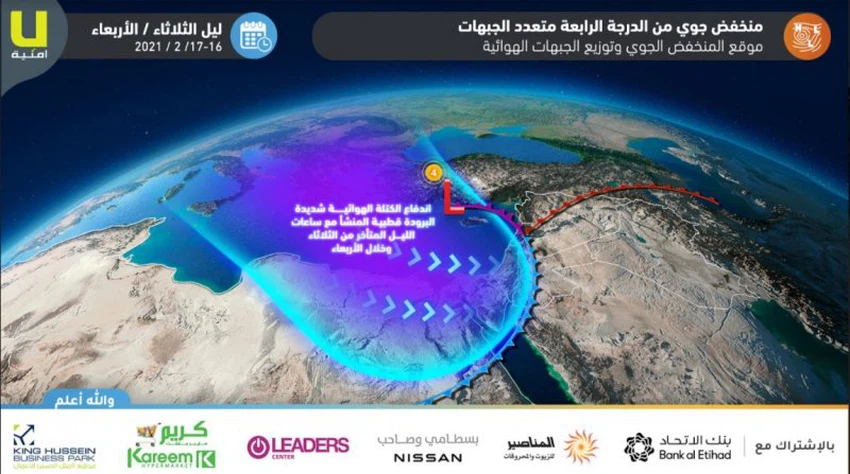
A cold air front crosses the kingdom on Tuesday evening and night
The deep depression is expected to be concentrated over the island of Cyprus with the evening and evening hours of Tuesday, and the Kingdom crosses a cold air front at the front of the cold polar air mass, as the rain gradually turns into snow over the mountain heights of more than 900 meters, and may fall below that Dawn and Wednesday morning. The precipitation is in the form of showers of rain and hail, and it may intensify sometimes.
Snow is expected, especially in the north of the Kingdom ... it spreads in the afternoon and evening towards the rest of the heights
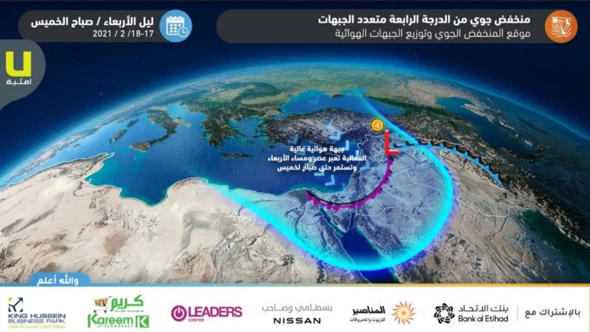
On Wednesday, a new air front is approaching the Kingdom, so the precipitation is regular in the northern regions of the Kingdom, while the precipitation will weaken in the rest of the regions, as intermittent showers of snow fall towards parts of the central and southern highlands.
High efficiency snow front expected in the afternoon and evening
With the hours of afternoon and evening, the Kingdom crosses a new air front, working on the spread of the patch of snow and its regularity towards areas that are more than 800 meters above sea level, extending below that at different periods, and extending successively towards the southern heights, especially Karak and Tafila, and the snow is thick at times and accompanied by thunder Sometimes, in conjunction with inclement weather. And rain mixed with cold showers and sometimes heavy in areas lower than that altitude.
Expectations indicate that snowfall will continue until Thursday morning, to weaken the opportunity after that, and Arab Weather advises the need to follow the latest forecasts and weather alerts first, Powell to know the latest developments that may affect the weather.


Arabia Weather App
Download the app to receive weather notifications and more..